 |
||
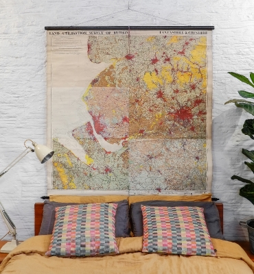
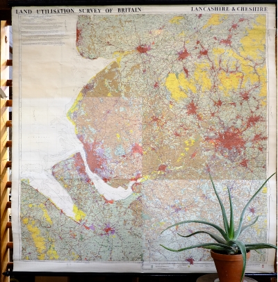
LAND UTILISATION SURVEY OF BRITAIN, LANCASHIRE & CHESHIRE. DATED 1935. LINEN BACKED MAP ON WOODEN BATTENS. |
||||
 |
 |
 |
||||
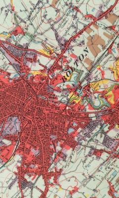
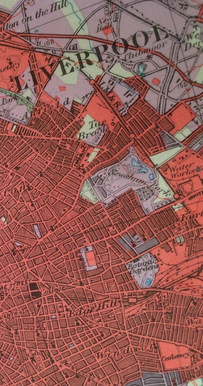
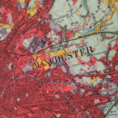
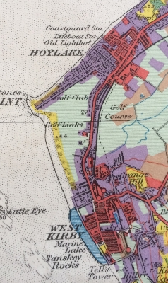
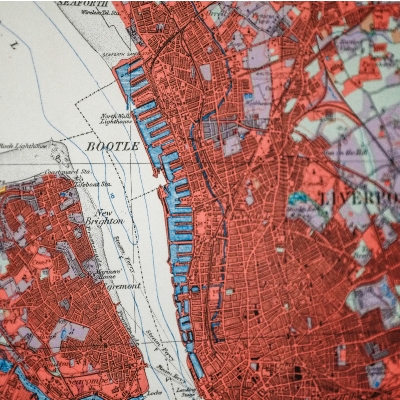
The Land Utilisation Survey (1930-1938) was based at the London School of Economics under the direction of Professor Sir Dudley Stamp who, in this 3 minute clip on the BBC, discusses The World Land Utilisation Survey Project during his apperance on Desert Island Discs in 1963. Given that it was recorded 55 years ago, it's prescience is startling. Information was gathered about land use across England, Wales and Scotland, recorded at the scale of 6 inches to one mile using the County Series sheets produced by the Ordnance Survey. Much of the survey work was undertaken by school children and students supervised by geography teachers and Land Utilisation Survey staff between 1932 & 1934. Each group surveyed their own parish using the 6 inch maps and "seven classes of land use". Classification employed relatively few categories. The base-map was overprinted with a wash of six basic colours to indicate broad land-use categories: Yellow (moorland and heath), light green (grassland), dark green (woodland), brown (arable), purple ('gardens etc.') and red (agriculturally unproductive). Built-up areas showed only two categories of urban (red) and suburban (purple) land. The key subdivides suburbs into 'houses with gardens sufficiently large to be productive of fruit, vegetables, flowers, etc.' and 'new housing areas, nurseries and allotments'. Urban areas were subdivided into 'land so closely covered with houses and other buildings as to be agriculturally unproductive'. The financial position of the project was always precarious, however with the advent of World War II it's importance became apparent for both agricultural and post-war planning. Government funding became available for the publication of the series however the printing plates of the pre-war maps were destroyed by bombing.
£ 265 SOLD
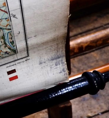
ITEM No: DIMENSIONS: 155cm(h) x 148cm (w) ORIGIN: Printed in the UK, map dated 1935. CONDITION: Fair condition, with some crumpling to the edges and a couple of small tears. Individual pages have been pasted on to the linen backing. |
||||||
 |
||||||
 |
||||||
 |
 |
 |
||||

|
|
M: 07952 187121 M: 07932 626740 T: 01373 452989 |
|